SJ API

Main navigation

  • Home
User account menu
  • Log in

Breadcrumb

  1. Home

Byskealven

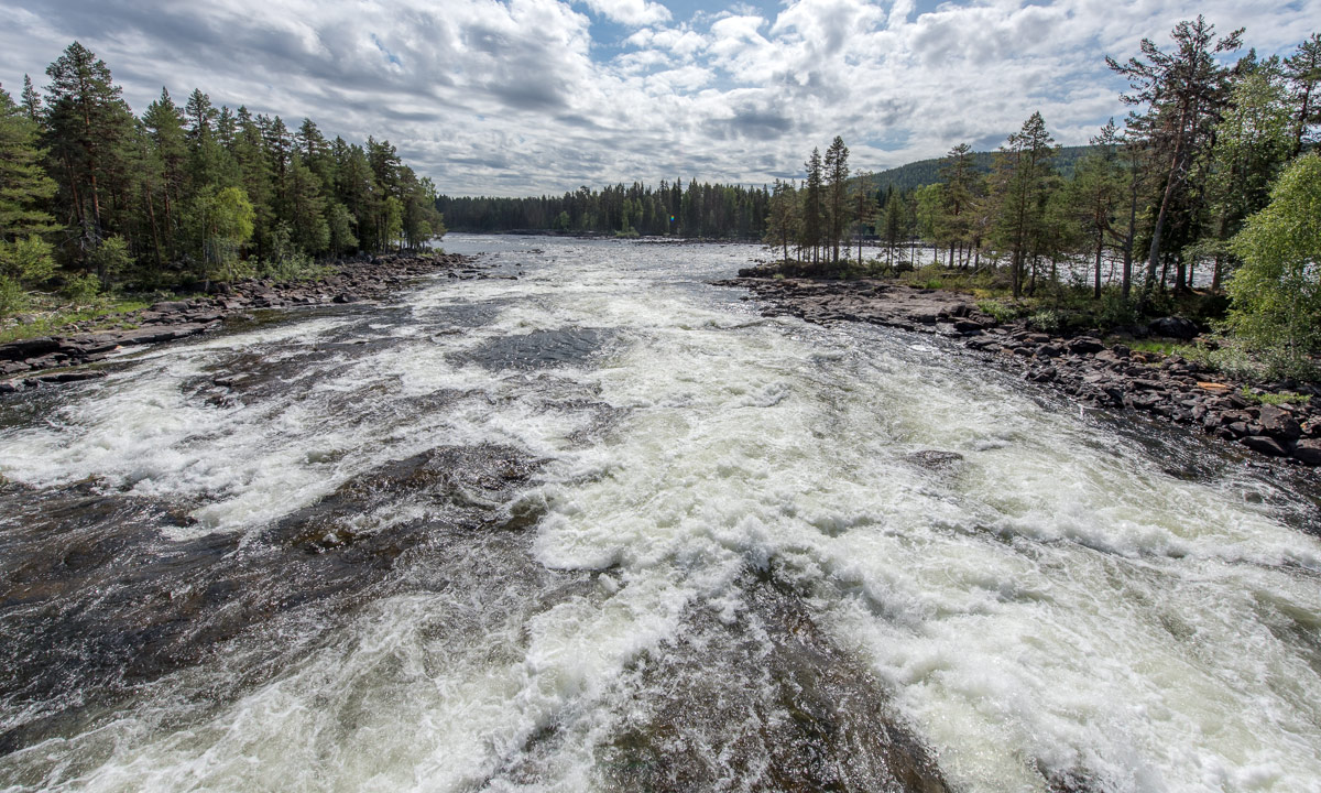
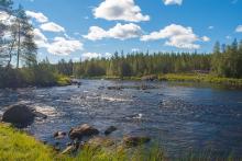
The Byske River is a 215km long undeveloped wild salmon river located in the area of Northern Sweden formerly known as the Norrland County.It stretches 134 miles from the Gulf of Bothnia to the Kilver in Arvidsjaur Municipality, passing through the current counties of Västerbotten and Norrbotten. The river is largely surrounded by dense forests and marshland. It is one of the few rivers in Sweden that still possesses its original strain of Baltic Salmon. It is a common fishing location known for its large salmon and trout populations and fishery conservation area. The river offers multiple fishing sites with widths ranging between 40 and 80 meters and an average flow velocity of approximately 41m3/s. Approximately 40km of the river contains rapids and/or currents which can be quite powerful.

Position
POINT (21.204659 64.950177)
Icon
icon-riwer.png (1.55 KB)
Place Type
River
GEOJSON
Settings
{
"weight":"3",
"color":"#4F729A",
"opacity":"0.9"
}
GEOJSON
byske-002.geojson (38.15 KB)
Settings
{
"weight":"2",
"color":"#9AC1D0",
"opacity":"0.8",
"fillColor":"#9AC1D0",
"fillOpacity":"0.4"
}
GEOJSON
byske-001.geojson (20.83 KB)
Image
Length
215
Basin size
3661
Flow average
37
Country
Västerbotten
Api Flow URL
https://vattenwebb.smhi.se/hydronu/data/chart?subid=29178&productionTime=

Zone 1

Lorem ipsum dolor sit amet, consectetur adipiscing elit. Vivamus at elit suscipit, dictum elit sit amet, rutrum quam. Quisque vitae arcu faucibus, luctus ipsum eget, consectetur erat. Vivamus odio quam, gravida eget molestie sed, pharetra a ipsum. Nullam porttitor luctus urna in auctor. Vestibulum nec lorem sit amet mi cursus egestas nec varius turpis. Nulla et purus laoreet, consectetur libero ac, sagittis lacus. Sed id ante porta, ultricies libero nec, luctus mi. Nulla iaculis non mauris id ultricies. Sed quis lorem leo. Vestibulum porttitor lacinia quam at semper. 

Byskeälvens FVO Västerbottensdelen

The bye river flows into the municipality of Arvidsjaur, in the lake-rich forest and marshland north of Storavan and the mouths of Bottenviken at Byske in Skellefteå municipality. The highest coastline (your sea reached the highest during or after the last ice age) is passed approximately at Nyfors, one mile downstream of the Mooring. The bottom part, from Bjørsel til havet, falls about 38 meters in 11 kilometers.

Of the 3 662 km² of the catchment area are 2,792 km² (76%) in Norrbotten County and the rest in Västerbotten County.

Fällfors i Byskeälven

The migration of salmon continues throughout the summer and the river is filled with fish right up until the spawning which begins in the fall. The salmon's migration begins far out in the Baltic Sea and the destination of the journey is in this case the Byskeälven. 28 kilometers upstream of Byskeälven from the sea is Fällfors. Here, Skellefteå municipality has a fish counter to be able to follow the salmon and trout migration for monitoring purposes. The fish counter is equipped with a camera which, in addition to assessing size, also enables assessment of species.
 

Pagination

  • Previous page
  • 4
Byskealven
RSS feed
Powered by Drupal